East End (Superior), Wisconsin
Superior's original settlement: the oldest housing in the city, a Carnegie library that is now somebody's house, and the bay at the end of the street.
The East End is where Superior started. The first settlement on this side of the harbor dates to the summer of 1853, and locals still call the neighborhood Old Town for that reason. It runs from roughly 13th Avenue East to 31st Avenue East, with Superior Bay on one side and the Nemadji River closing the other, and it holds the oldest housing stock in the city on a tight, flat grid of narrow lots. Prices sit well below comparable Duluth neighborhoods, the walking and cycling is genuinely good, and the basement is the thing you inspect hardest.
Everything about East End (Superior)
Each part of the East End (Superior) guide has its own page. Start anywhere.
Two facts organize everything about this neighborhood.
HistorySuperior's beginning is here rather than downtown. The summer of 1853 brought the first settlement to the ground north of the Nemadji River, and the area was platted as the townsite of what would become the city. Speculative money followed the opening of the Soo canal, betting on this corner of the lake as the ...
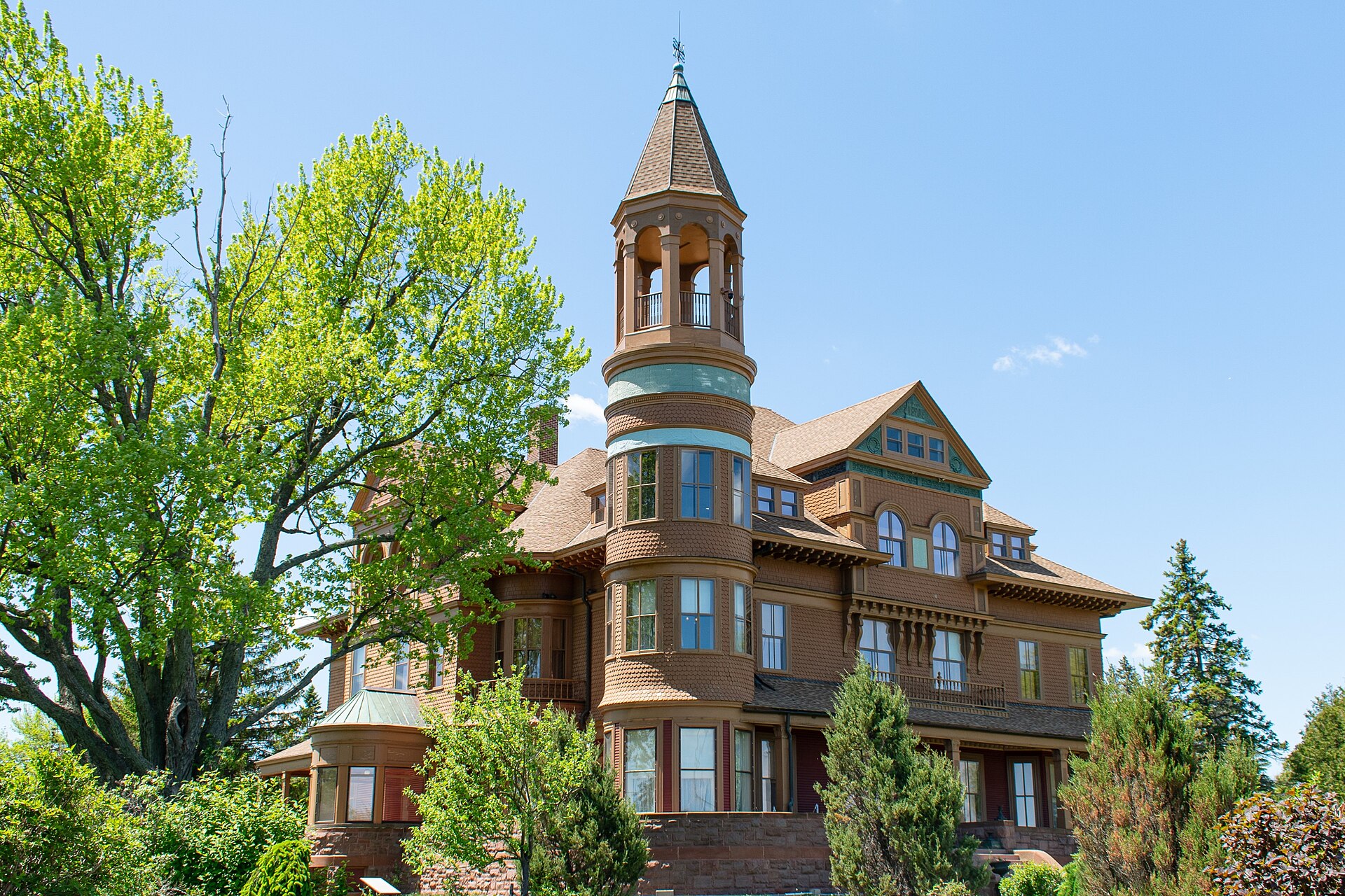
CharacterThe East End reads as a quiet, worn, and genuinely historic residential neighborhood with water at both ends. Streets are narrow and gridded, lots are small, and garages are detached and reached from alleys on many blocks. There is no continuous commercial strip, just corner businesses and taverns scattered through the residential fabric, which is ...
Who lives hereTenure in the tract covering the East End runs 69.5% owner-occupied and 30.5% renter, with a median gross rent of $971 (ACS 5-year 2023, Census Tract 209, accessed 2026-08-14). The duplex share of 8.8% is the highest in Superior, and a good deal of that is East End stock, older houses converted into upper and ...
HousingThe stock runs from the 1880s to roughly 1969, with the bulk of it pre-1940. Expect worker cottages, some Queen Anne detail on the larger older houses, bungalows and four-squares from the early twentieth century, postwar ranches filling gaps, and a meaningful number of upper-lower duplex conversions. Lots average around 5,000 square feet on a ...
SchoolsThe East End is in the School District of Superior, about 3,900 students, and the structure makes most of the school question easy. There is one middle school, Superior Middle School at 888 students, and one high school, Superior High School at 1,256, so every student in the neighborhood follows the same secondary pathway.
Parks & recreationBarker's Island is the neighborhood's front yard: a made island on the bay with a beach, a marina, a maritime museum, and the walking loop most residents use. The Osaugie Trail runs the bay shore from here toward downtown and is the main cycling and walking route, and on flat ground with a regular grid ...
Restaurants & diningDining inside the neighborhood is neighborhood-scale: The Choo Choo Bar and Grill is a long-running East End bar and grill, and Gronk's Grill and Bar is a short drive on the east side. For range you go west. Thirsty Pagan Brewing, Superior's best-known brewery and pizza room, is about ten minutes away at 1615 Winter ...
Churches & worshipThe best story on these streets is the library that stopped being a library. Andrew Carnegie gave Superior $20,000 in 1917 for a branch in the East End, and it opened on 10 September 1918. It was the last Carnegie library ever built in Wisconsin, the closing entry in a program that had put up ...
Is it right for you?Buy here if you want an old house with real character at a Superior price, and if you will pay for a thorough inspection rather than skipping it to win a deal. It suits first-time buyers, budget-conscious households, people who want to cycle and walk on flat ground, and investors looking at the duplex stock, ...
Getting around in East End (Superior)
Downtown Superior is about five minutes west, downtown Duluth about fifteen over the Blatnik Bridge, and the Miller Hill retail corridor about twenty-five. Everything here is a vehicle proposition for anything beyond the neighborhood, though the flat grid and the Osaugie Trail make short local trips genuinely walkable and cyclable.
US 2 and US 53 are the through routes south and east. Confirm current transit routing with the Duluth Transit Authority, which runs the Superior service, rather than relying on this page for it.
Major roads: US 2, US 53, East 2nd Street, Ogden Avenue, 21st Avenue East.
DTA bus routes: 211 (Superior, Billings Park, East End). Routes and timetables change, so confirm with the DTA.
Biking: The Osaugie Trail runs the bay shore and is the neighborhood's main cycling route. Flat ground and a regular grid make the East End genuinely bikeable, which almost nothing in Duluth is.
The hill: Flat, on the bay flats, with the ground falling away toward Superior Bay on the north and the Nemadji on the south and east. As everywhere on this side of the harbor, the water table is high and the basement is the thing to inspect. On measurement, six USGS spot elevations across the City of Superior span only about 30 feet, from 648 to 678, with the east-end reading near the low end at 649 (USGS Elevation Point Query Service, 2026-08-14). That is a city-wide range rather than a reading inside these boundaries, so treat it as the band this neighborhood sits within rather than an exact figure.
Safety & feel in East End (Superior)
Quiet on the interior blocks and busier on the edges, where the bay side and the Nemadji corridor carry rail and port activity. Lake boats sound their horns in the harbor, which residents stop hearing and visitors notice. The industrial intensity east of here, around the ore docks and Wisconsin Point, is greater than anything in the East End itself; the allouez-itasca page carries the dust disclosure that applies to that ground.
Daily life in East End (Superior)
There is no grocery, pharmacy, or hardware store in the neighborhood, so the weekly shop happens on the Tower Avenue or US 2 corridors five to ten minutes away. What the East End gives you instead is the thing that is hard to buy: a walkable grid, water at both ends of it, a park and a marina within a few blocks, and a housing cost well under what the equivalent age and character would fetch across the bridge in Duluth.
Pharmacy, hardware & gas: Pharmacy, hardware, and fuel are on the Tower Avenue and US 2 and US 53 corridors rather than in the neighborhood.
Where you shop and eat out
A scattering of corner businesses, taverns, and small storefronts rather than a continuous commercial strip. Tower Avenue downtown is the nearest full retail district, about five minutes west.
How East End (Superior) scores
Is East End (Superior) right for you?
You'll love it if
- The oldest and most characterful housing stock in Superior, at prices well below comparable Duluth neighborhoods.
- Genuinely flat and bikeable, with the Osaugie Trail and Barker's Island at the end of the street.
- Real history in the built fabric: an 1898 fire hall, a 1908 church, a 1932 theater, and the last Carnegie library built in Wisconsin.
- Water on two sides, the bay to the north and the Nemadji to the south and east.
- One middle school and one high school in the district, so the secondary pathway is settled from the day you move in.
Look elsewhere if
- High water table and century-old foundations: the basement is the single most important inspection item, and it is not optional here.
- Condition varies sharply block to block, so a neighborhood-level price is close to meaningless without comparable sales.
- No grocery, pharmacy, or full retail inside the neighborhood.
- Rail and port noise on the edges nearest the bay and the Nemadji.
- The elementary assignment is not obvious from the address and has to be confirmed with the district.
If you like East End (Superior), also look at
Immediately west across 13th Avenue East, the 1862 plat, with a higher ownership share and somewhat higher prices.
Allouez-Itasca (Superior)East beyond the Nemadji toward the ore docks and Wisconsin Point, cheaper again, with a taconite and rail dust disclosure worth reading.
Downtown SuperiorFive minutes west on the bay, the Tower Avenue commercial core and the most walkable district in the Twin Ports.
South End (South Superior)South along Tower toward the US 2 and US 53 strip, with the second-highest duplex share in the city.
Billings Park (Superior)The far west end of Superior on the river bluff, the highest ownership share in the city and the best outlook.
SuperiorThe citywide guide: market, taxes, schools, and how the three Superior governments differ.
Recent coverage of East End (Superior)
City councilors laid out spending priorities for next year, including streets, recreation and transit.
Related: Downtown Superior North End (Superior) South End (South Superior) Central Park (Superior) Billings Park (Superior) Allouez-Itasca (Superior)
The utility began building a bill-assistance program for qualifying households as lead service line work continues.
Related: Downtown Superior North End (Superior) South End (South Superior) Central Park (Superior) Billings Park (Superior) Allouez-Itasca (Superior)
The neighborhood's annual family days appeared on the city events calendar.
The council awarded a contract for street reconstruction in the neighborhood.
Headlines link to the original publisher. We summarise and attribute, we do not republish. Last checked 14 Aug 2026.
Know East End (Superior) well?
Live here, grew up here, or just know it better than we do? Tell us what we're missing, a place we should cover, or something we got wrong.
Where these facts come from
- Gotta Be Superior, historic sites in the East End neighborhood (boundaries 13th to 31st Avenue East, 1853 settlement, landmark list) accessed 2026-08-14
- Wisconsin Library Heritage Center, Superior's Carnegie library buildings (East End branch opened 10 September 1918, last Carnegie library built in Wisconsin, converted to a private residence 1992) accessed 2026-08-14
- St. Francis Xavier Catholic Church, Superior WI, parish website accessed 2026-08-14
- US Census Bureau, American Community Survey 5-year 2023, Census Tract 209, Douglas County, Wisconsin accessed 2026-08-14
- US Census Bureau geocoder, Public_AR_Current / Census2020_Current (centroid and tract assignment) accessed 2026-08-14
- NCES Common Core of Data, School District of Superior (LEA 5514670), 2024-2025 accessed 2026-08-14
- City of Superior, Wisconsin, official website accessed 2026-08-14
- USGS Elevation Point Query Service, spot elevations at verified geocoded points accessed 2026-08-14
Last reviewed 2026-08-14 by Guide editorial.